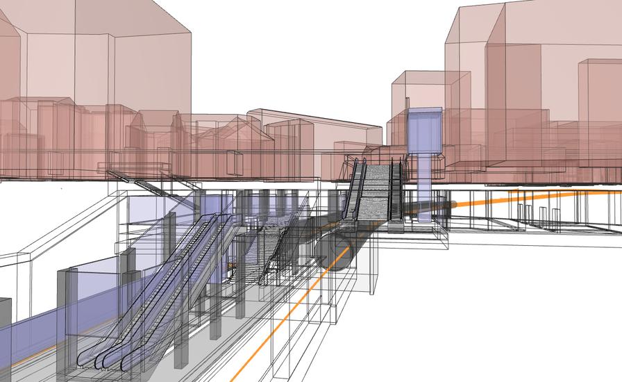
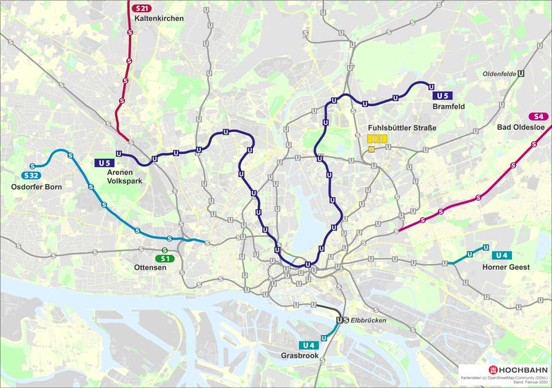
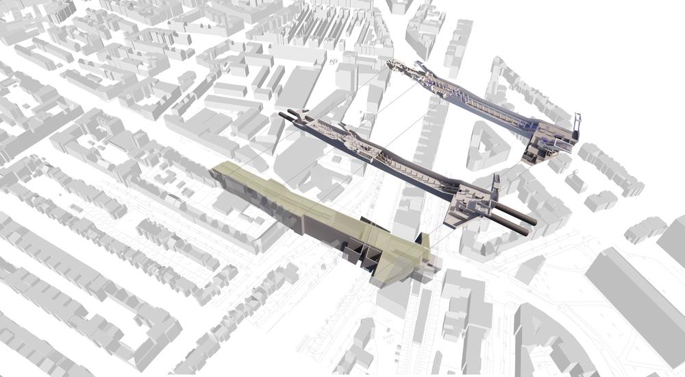
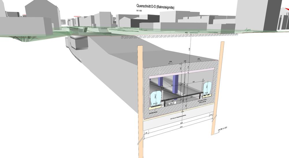
With construction of a new, fully automated subway line straight across the city, Hamburg’s authorities are aiming to close hefty gaps in the subway network. The future U5 line will link multiple districts – from Bramfeld in the east across downtown and the UKE and on to the arenas of the Volkspark in the west – in total the route runs around 24 km, and will offer some 150,000 residents a connection to the subway network.
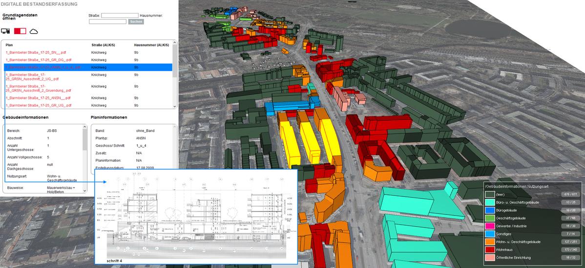
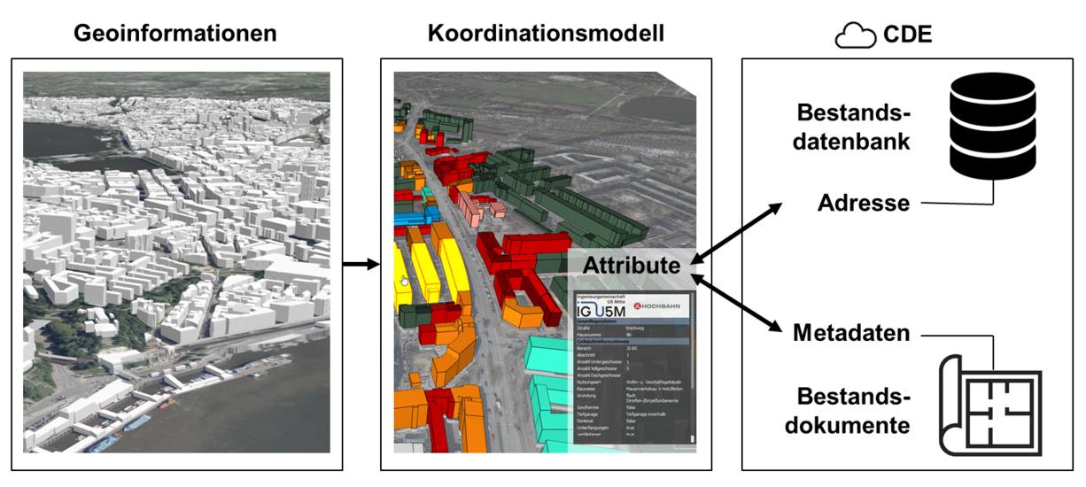
WTM Engineers worked as part of the engineering consortium Ingenieurgemeinschaft U5 Mitte on behalf of Hamburger Hochbahn AG, producing a preliminary draft for the approx. 17-km-long section known as U5 Mitte, which stretches from City Nord to the arenas. During planning, BIM methodology played a crucial role – not only in the development and visualization of structural work and construction processes, but, most importantly, in the structured management of virtually incalculable volumes of data in the planning process.
An article on precisely this subject has appeared in “Beratende Ingenieure” magazine, published by the German Association of Consulting Engineers (VBI): „U-Bahn-Planung und Informationsmanagement vereint durch BIM“